
I’ve been interested in checking out the trails in the High Tor Wildlife Management Area for quite some time. So when I got a text message from a friend Friday afternoon asking if I was interested in joining a last-minute hiking trip to the area I just couldn’t say no. The High Tor Wildlife Management area is located just east of Naples, NY, about an hour away from Rochester. Tor refers to a hill or rocky peak, which accurately describes the terrain of this area. Hikers are treated to steep wooded hills, eroded cliffs, gullies and waterfalls.

We drove to the parking area off of Parish Hill Road to find a trailhead for the Hi Tor Blue Trail. We set out to hike up to an overlook with a view of Canandaigua Lake, checking out a bit of Conklin Gully along the way. We didn’t bring a trail map since we thought the trails looked pretty straight-forward from our internet research (ha!). Unfortunately it didn’t take very long for us to realize we were no longer following a marked trail and needed to regroup. Around this time we started to hear gunfire in the area, reminding us that we were hiking in a popular hunting area during hunting season. As we discussed how near or far the gunfire might be, we noticed a few shotgun shells on the trail near our feet – ugh! I have no problem sharing outdoor spaces with all types of recreationalists, but I have zero tolerance for those who litter. Leave no trace means exactly that, and leaving shotgun shells on the trail is no different than leaving a granola bar wrapper – just don’t do it, okay?
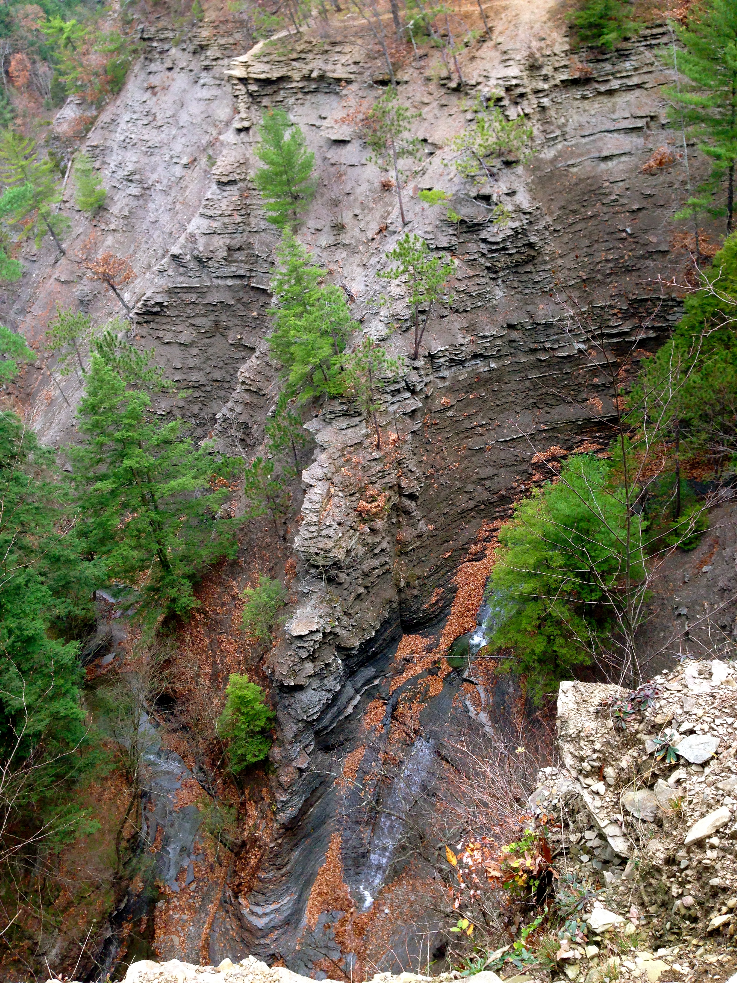
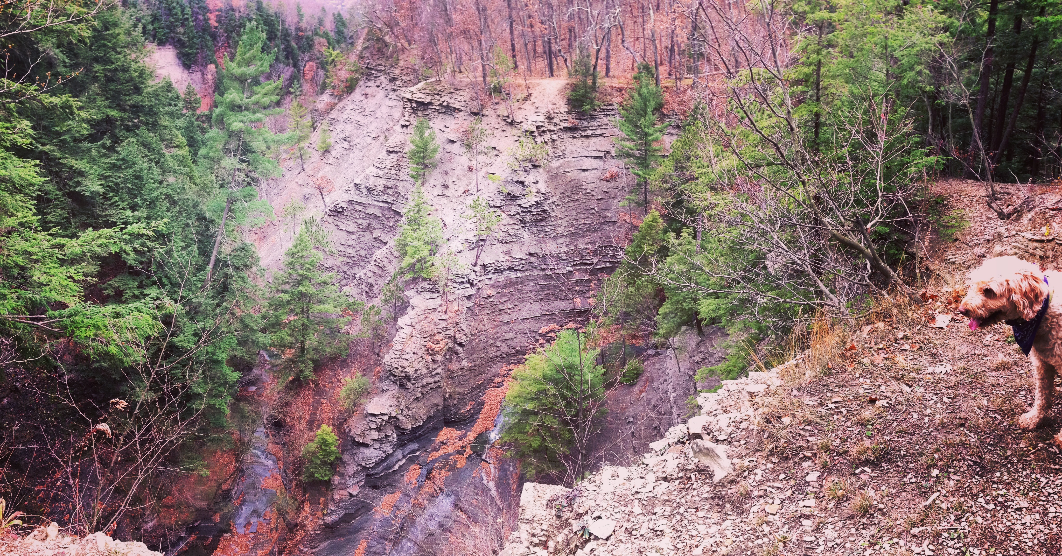
We were a little nervous about hiking with two dogs in this area during hunting season, but we decided that it was getting late enough in the day to not pose much of a threat. We backtracked to where we saw the Blue Trail markings turn toward the gully and proceeded along the trail, hoping to make our way up to the Canandaigua Lake overlook. Before long, we crossed a shallow, rocky part of the gully and followed the trail up to a steep ledge along 100 ft. sheer walls. This portion of the trail offered amazing views of the gully’s rocky walls and waterfalls below.

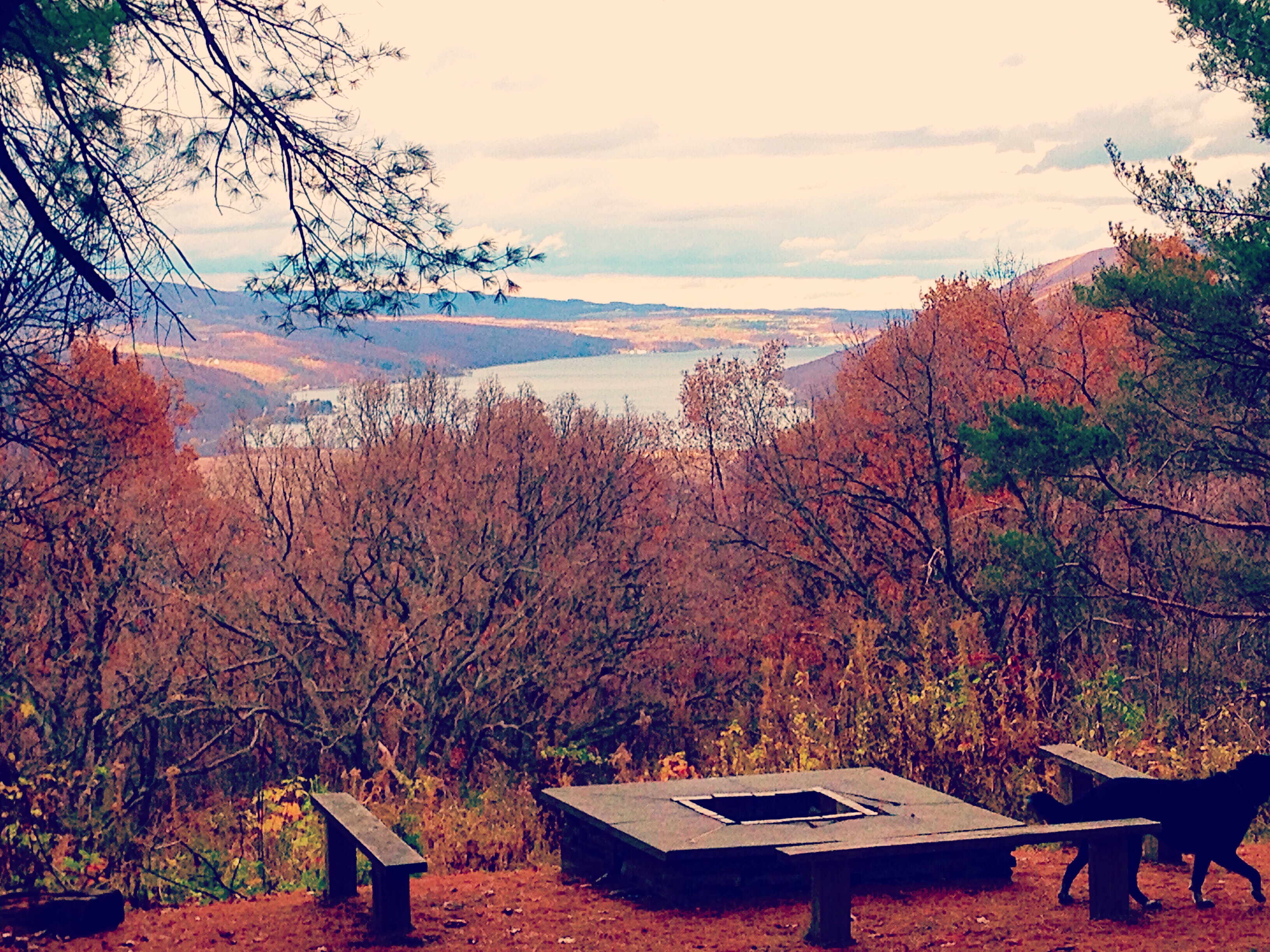
After stopping to take in the scenery and snap some photos, we pressed on and reached a point where the trail widens to a space large enough to fit an ATV. At this point the trail becomes pretty steep, and goes straight up until a large clearing with a lean-to, outhouse, food locker and fire pits. This is a beautiful camping spot at the Canandaigua Lake overlook, but unfortunately camping is seasonal and restricted to organized groups by permit only.

We stopped for a while again to enjoy the spectacular view of the lake and conveniently use the outhouse near the camping area. A few hikers came from the other end of the trail and stopped briefly to chat. They had driven from Buffalo to spend the day in the area. We decided to follow the Blue Trail a bit longer, until it intersected a section of the Finger Lakes Trail that connected back to the steep, wide section of the Blue Trail again.
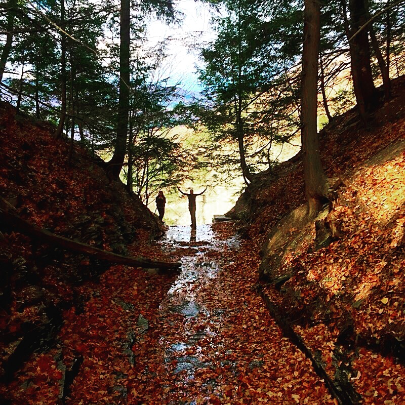
On the way down we wandered off trail a bit to explore a tributary which ran into the gully, creating a small waterfall. We climbed down to the top of the waterfall and looked over the steep ledge down to Conklin Gully before making our way back to the trailhead via the Blue Trail.
As we passed by the Conklin Gully overlook section of trail again, we noticed two men hiking through the gully below us. A popular way to hike this area, particularly in warmer weather, is to hike straight through the gully. Some sections of the gully have steep waterfalls, and sometimes there are ropes to help hikers traverse these sections. The waterfall directly below where we were was one such section, and we watched the men use the rope to climb up alongside the waterfall with ease.

It was a short hike back to the trailhead, which made us realize exactly how far out of the way we had initially gone when starting out. Overall it was a very enjoyable hike, with some challenging uphill sections, gorgeous views and exciting terrain. I’m already looking forward to coming back to the area in warmer weather to hopefully hike all the way through the gully. We’re also hoping to plan a section hike of the Finger Lakes Trail, which passes through the High Tor Wildlife Management Area and connects to the Hi Tor Blue Trail. So much to explore!

What’s your favorite hiking spot in the Finger Lakes? Share your experiences in the comments below!
Keep exploring,
