Fall & Winter In One Hike: Street & Nye Mountains

The fall colors of the Adirondacks were visible through the snow-covered trees on the trail to Street and Nye Mountains.
The fall colors of the Adirondacks were visible through the snow-covered trees from a clearing on the trail to Street and Nye Mountains.

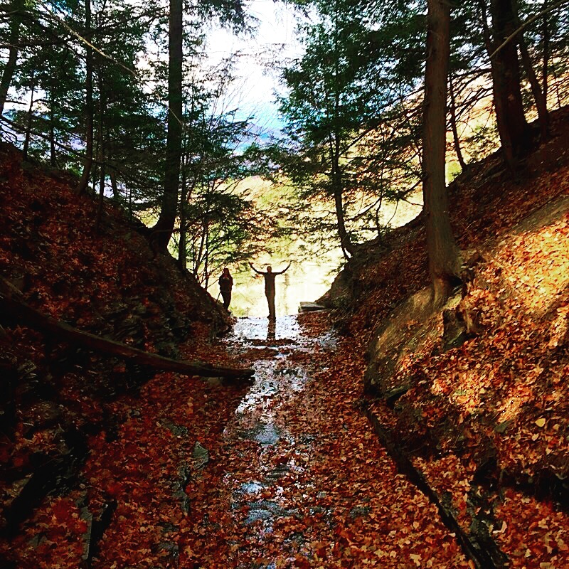
Today was a mild autumn day in Rochester, and as winter draws closer I can’t help but reflect on a wild weekend I had just last month, which provided the first taste of wintery weather this season. The girls planned another Adirondack adventure in an attempt to bag a couple more high peaks this fall. We booked a cabin in Wilmington, near Whiteface Mountain, and decided we would try to summit Street and Nye Mountains on a weekend in mid-October.

Access to Nye Mountain and Street Mountain are via unmaintained trails.
“Trail Not Maintained Beyond This Point.”

Street Mountain is number 31 of the 46 High Peaks, with an elevation of 4166 feet. Nye Mountain is the second shortest of the 46 high peaks, with an elevation of 3895 feet. Nye Mountain and Street Mountain are often climbed together in a single day hike. An unmaintained trail leads hikers to the summits of both mountains from the Mount Jo Trail near Adirondack Loj.

Signing in at the trailhead.

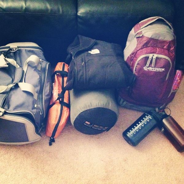
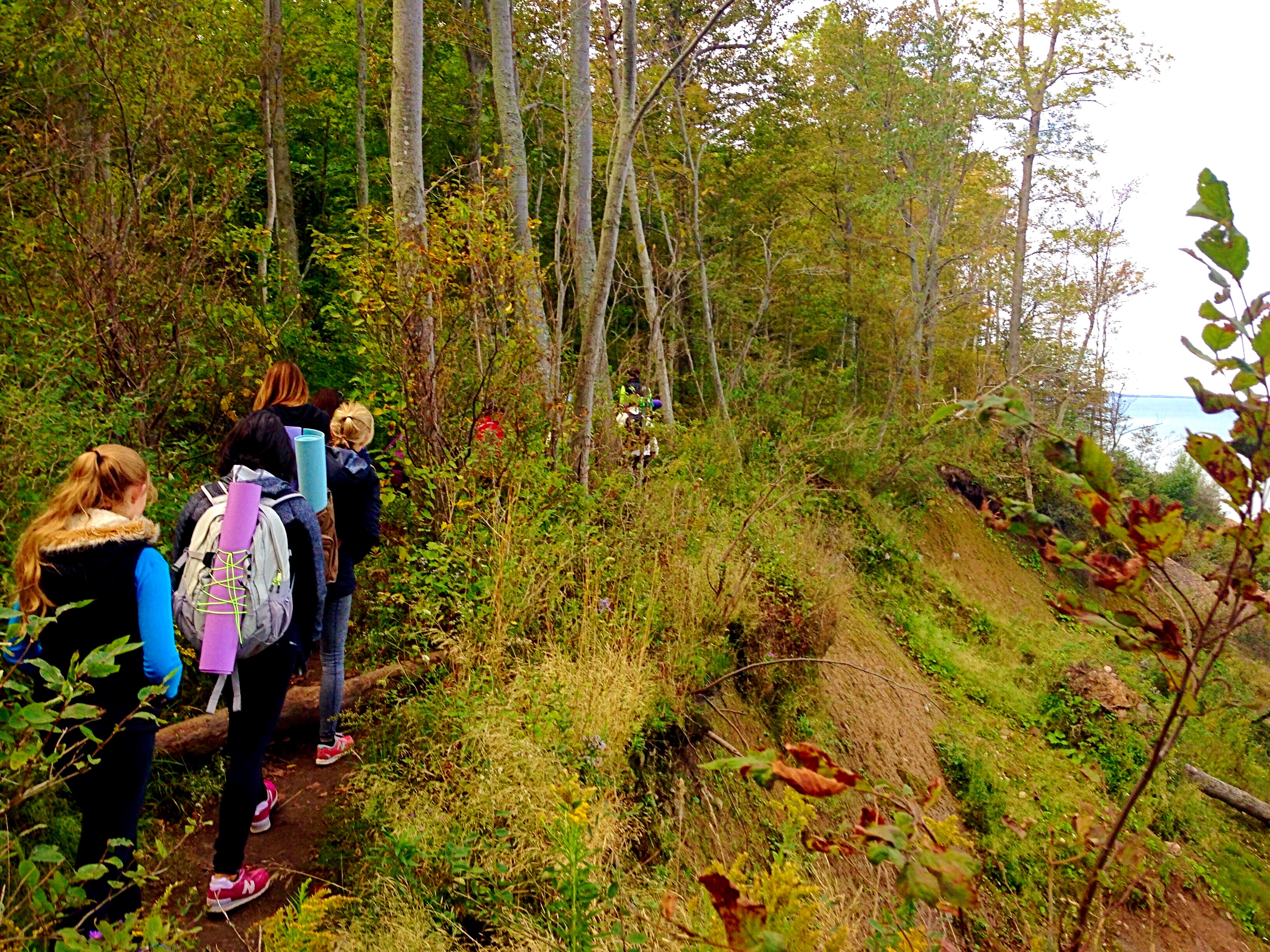
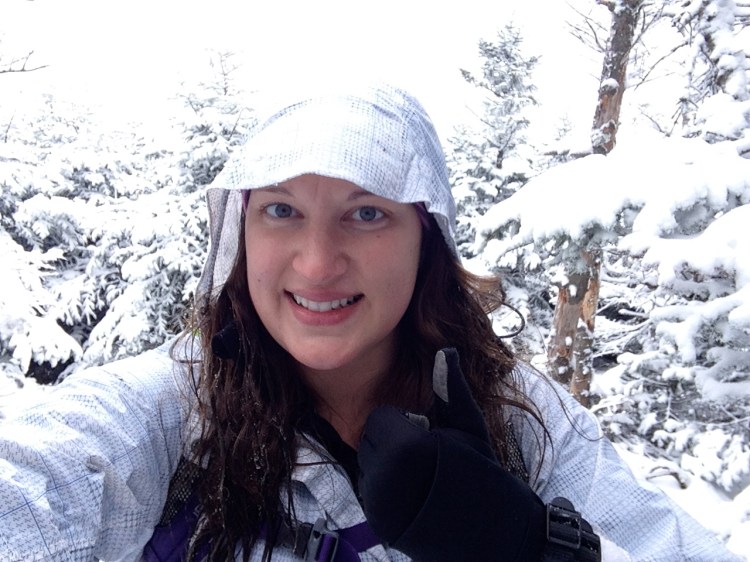
We had the largest group of any hiking trip I’ve been on so far – this time with six ladies and one gentleman (a friend managed to sneak her boyfriend!) – all of varying hiking experience and backgrounds. We got an early start and arrived at the Adirondack Loj first thing in the morning. After parking, packing up our day packs and getting properly layered in outerwear, it was time to make our way to the trailhead.


We had trail maps of the area and the High Peaks Trails guidebook, but we decided to stop and ask someone at the Loj the best way to get up to the beginning of the Street & Nye trail. This proved to be a costly mistake, as the instructions she gave us actually led us almost all the way up Mount Jo in a large loop before finding the unmaintained trail. This added an extra hour-ish and almost 2 additional miles to our planned hike!

IMG_2638_2
Much of the herd path looked just like this. Easy to follow, right?

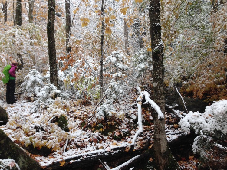
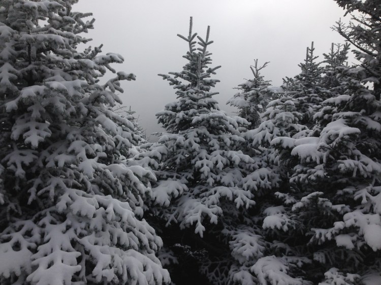
Things got interesting after we ventured out on the herd path leading up to Street and Nye Mountains. I imagine that following this herd path is usually pretty straightforward as it is the most popular route up these two “trail-less” high peaks, which are required for one to become an official 46er. However, the combination of leaf cover and light snowfall obscured much of trail for us, making it quite difficult to follow at times. Luckily there were a couple of groups heading up the same route ahead of us according to the trail register, and were able to find the herd path by following their footprints in the mud and snow.

IMG_2629_2

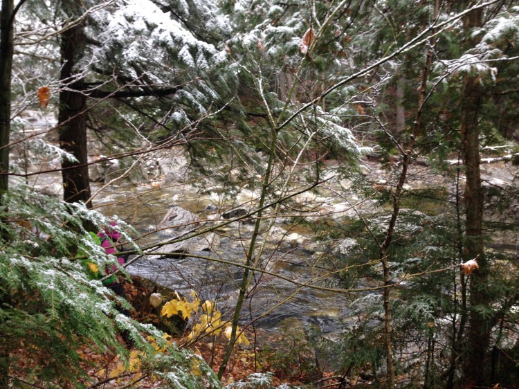
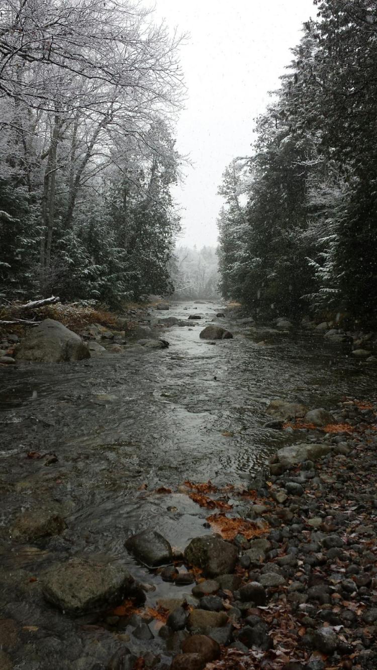
Before long the path comes to the Indian Pass Brook which requires crossing to continue. From what I’ve read, Indian Pass Brook appears to be typically less deep than it was the day of our hike, though I’m sure it can be much deeper in the spring with heavy rain and snow melt. After assessing the situation for some time, we decided to just take off our socks and boots, roll up our pants, and “ford the river!”

IMG_2780_2
I found myself in deep water somehow. Leave it to me!

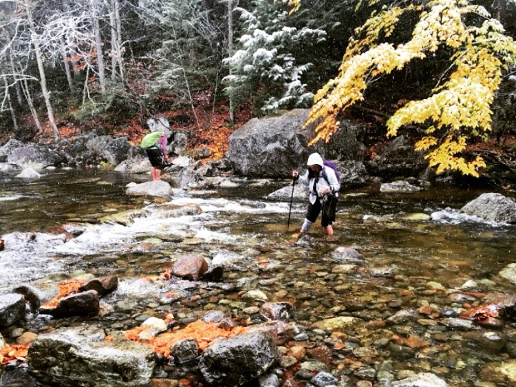
This was my first stream crossing, and it was pretty tricky despite the relatively shallow depth. Parts of the stream where we crossed had a pretty strong current, and the rocks beneath the water were sharp and slippery. The water felt barely warmer than freezing. After all, it was cold enough to be snowing during our entire hike! The best part about the stream crossing was putting our wool socks and boots back on after reaching the other side. My feet were in heaven after fording the icy stream!

IMG_2720_2

After a short distance there was another stream crossing, this one was narrower, shallower and had a large log that traversed it. I decided to “scoot” across the log while everyone else easily walked right across. My method worked well, until I tried to exit the log on the wrong side and my right leg slid into the stream up to my thigh. So much for dry feet!

IMG_2779_2
The second stream crossing.

The trail followed a brook most of the way up the mountain, crisscrossing it a few times. We continued on by following footprints of those ahead in the snow and mud. The trail was extremely muddy and wet from the constant snowfall, so after a while it didn’t even matter that my right foot was completely soaked from the stream crossing.

IMG_2640_2
Stopping to check in with the rest of the group via walkie-talkie.

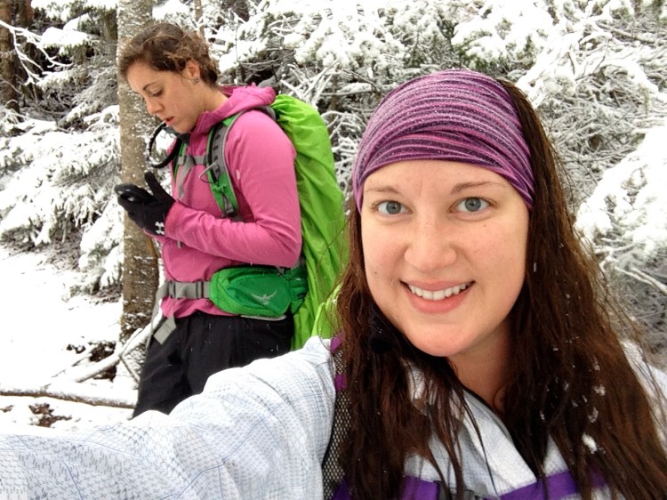
Eventually the fastest hiker of the bunch broke away from the rest and I tried my best to keep up with her. We stopped a few times to check in with the rest of the group behind us via two-way radio, and found out that three of the girls had turned around due to the weather conditions and difficulty of the hike.

IMG_2641
View from the clearing on the way up. All white everything!

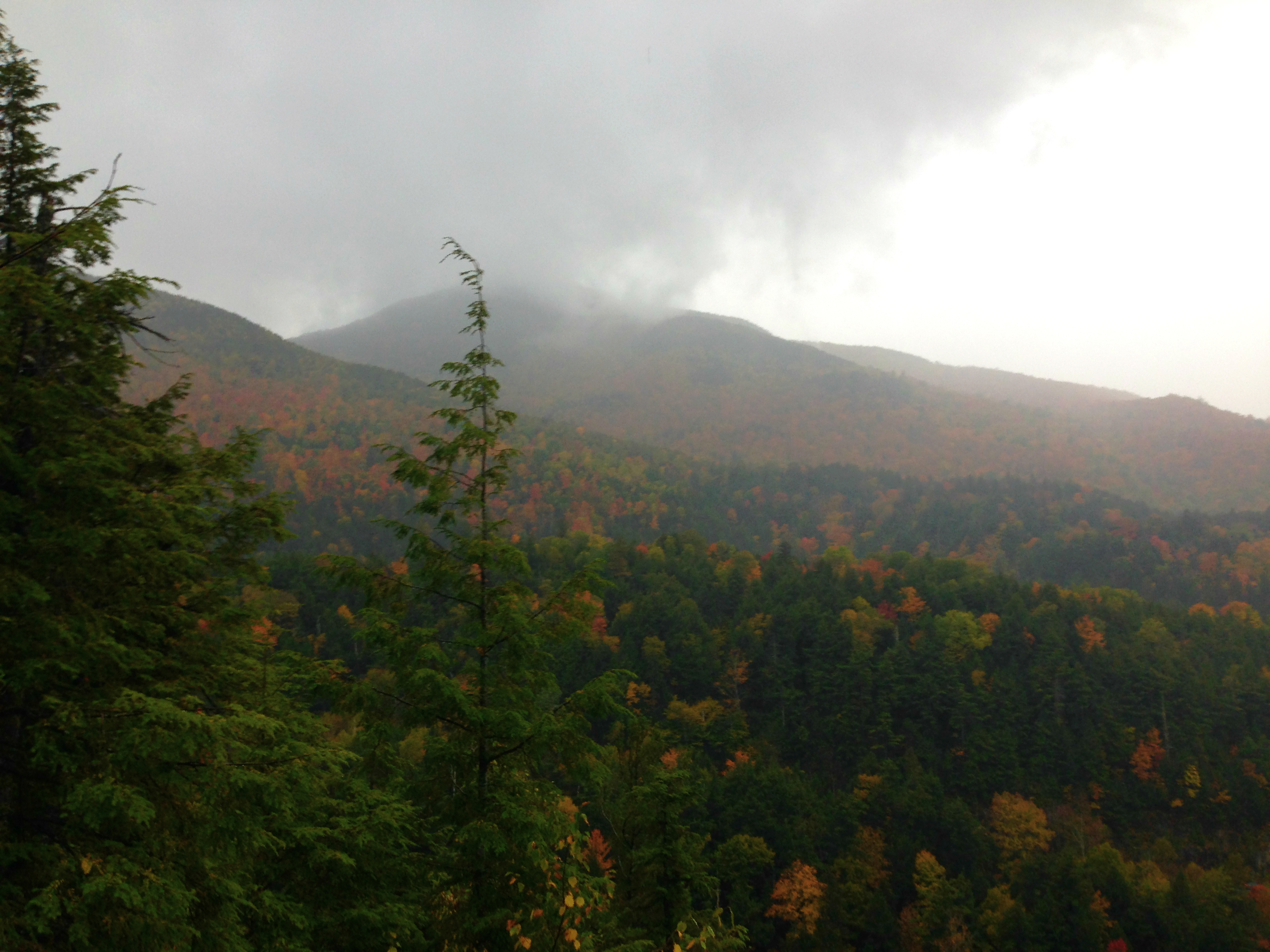
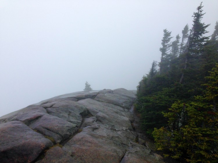
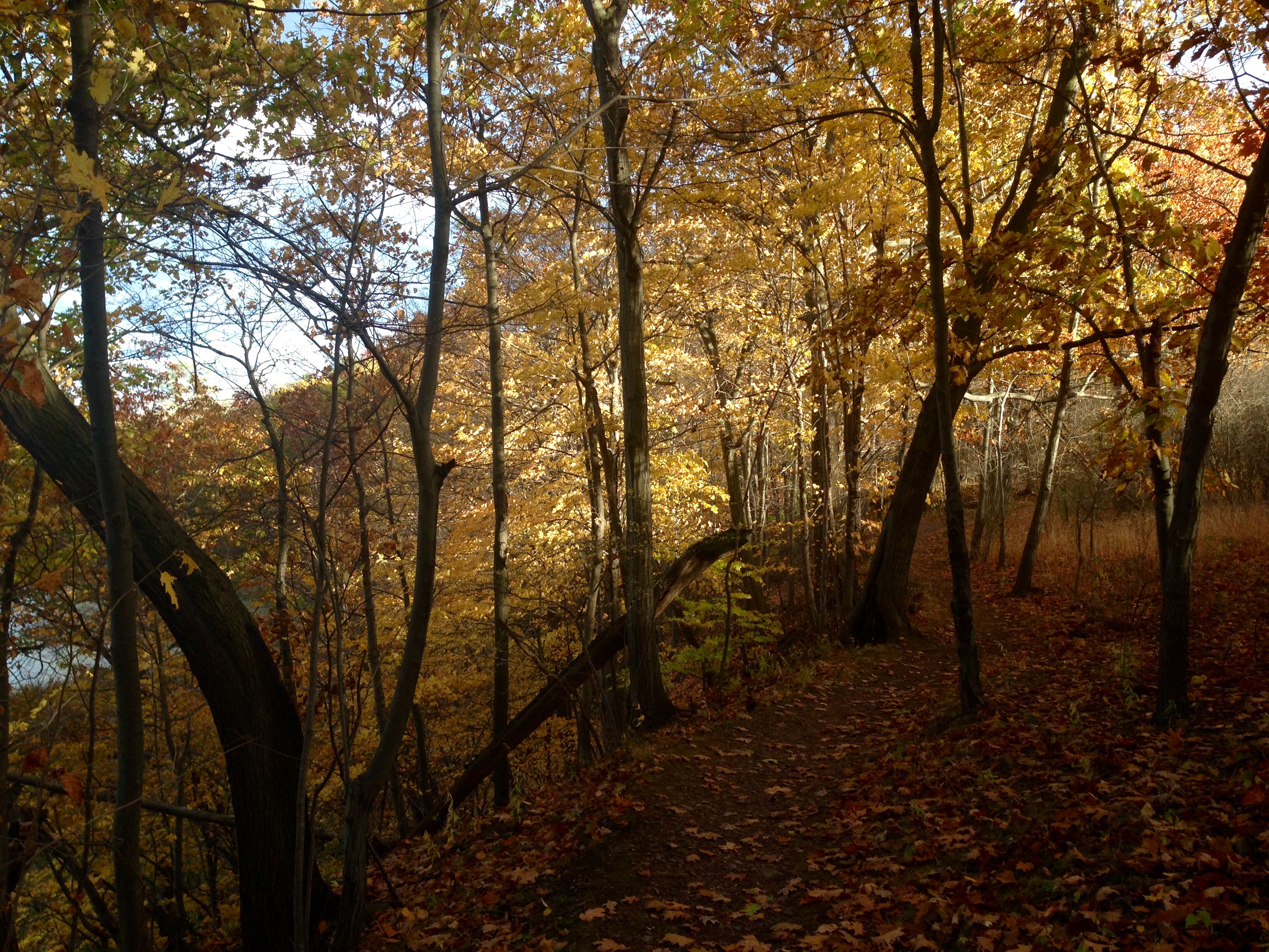
We eventually came to a rocky ledge on the trail with a clearing in the trees. This spot probably offers a pretty nice view, but all we saw was a white out. We passed a couple of hikers who were on their way down from the summits, and they said the clearing with the trail junction for Street and Nye was impossible to miss.

IMG_2650_2
A lovely view from the wooded summit of Nye Mountain!

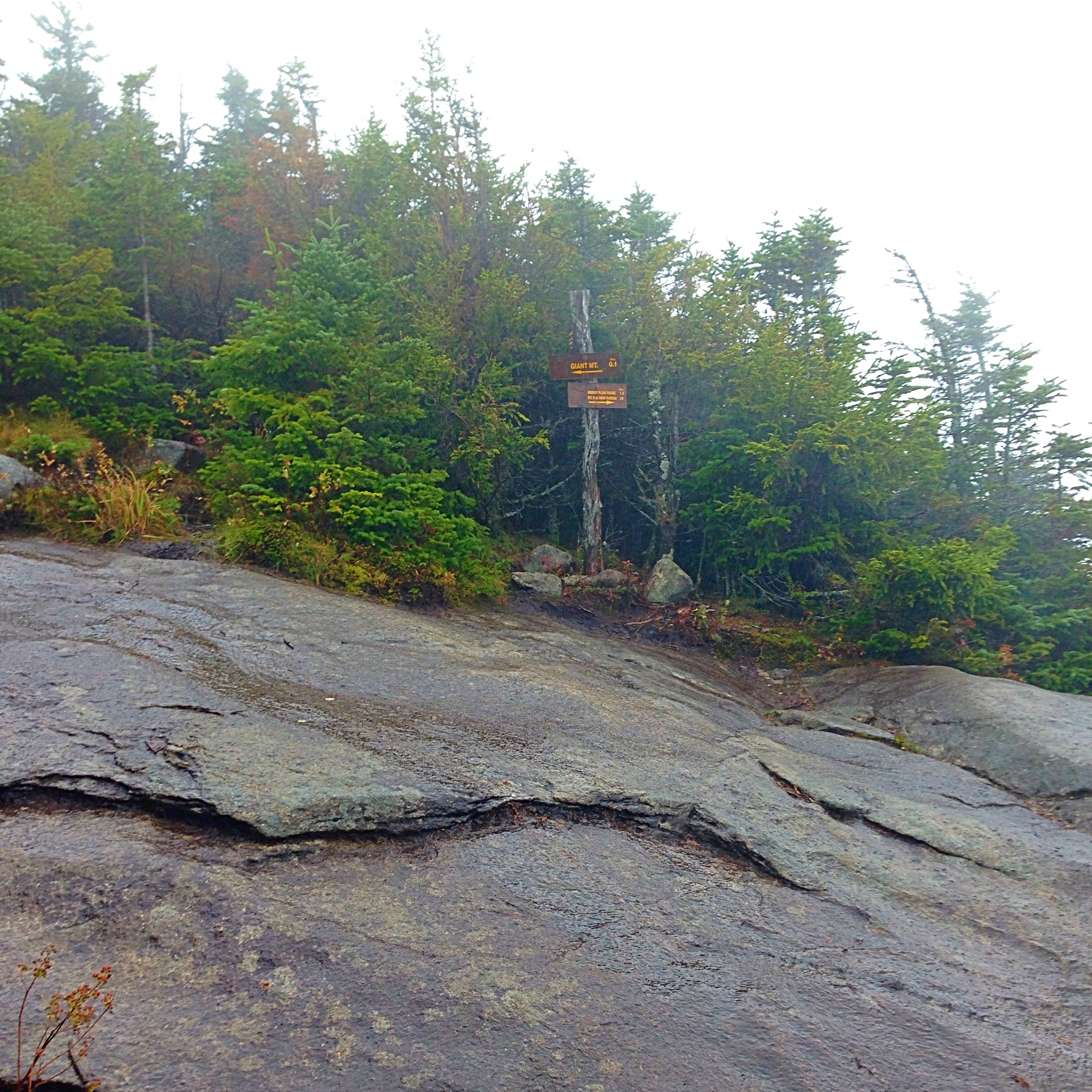
Well that was a bit misleading, since we somehow managed to go straight past the junction without even noticing! I suppose it’s because of how closely we were following the tracks to make sure we stayed on the path, but eventually the trail just seemed to stop completely and we couldn’t tell for the life of us where to continue.

IMG_2653_2
At the summit of my 7th High Peak!


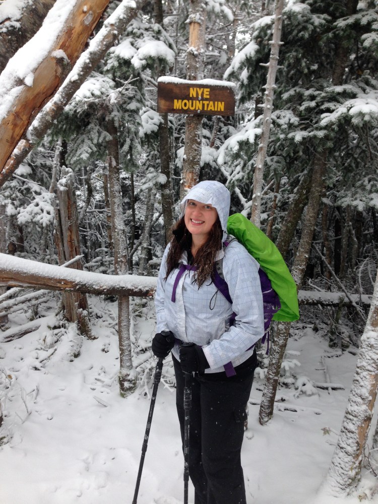
As we looked around in confusion, trying to figure out where or how we went wrong, I looked up and spotted the “Nye Mountain” sign above our heads. We had summited without even realizing it! We high-fived to another high peak conquered, and radioed to the other two who were behind us to see how far away they were.

IMG_2658_2
I think I will start calling us the “Three Mountaineers!”

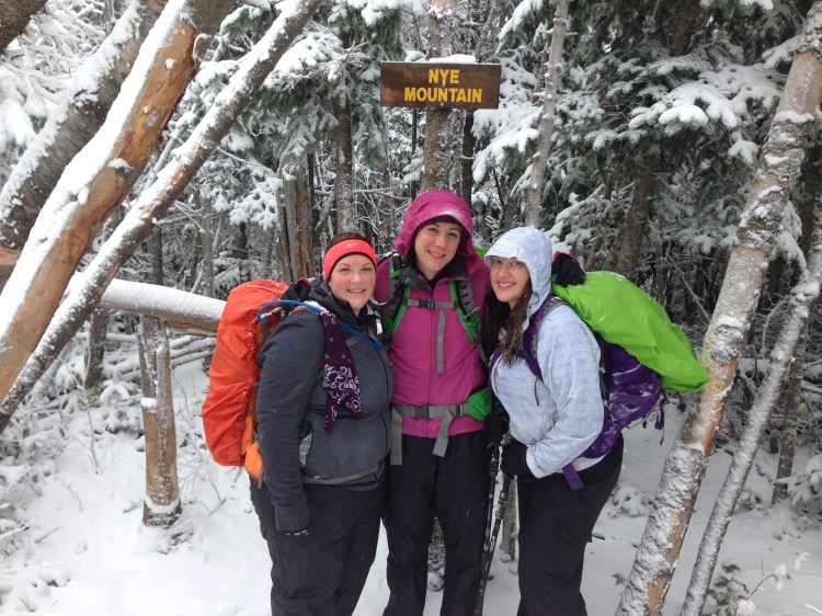
Just as we were about to head down to the junction to wait for the others, they came climbing up to the summit area. We joined them back up at the summit of Nye, snapped a few pictures, and decided to forge ahead to Street Mountain. This time when we came to the junction, it was slightly more obvious but also pretty clear why we missed it on the way up. Coming down the summit of Nye, there was a clearly visible rock cairn marking the spot where the Street Mountain trail veers off that we hadn’t seen before.

IMG_2671_2
The view from Street Mountain’s summit was no better.

The hike from the junction up to the summit of Street Mountain was pretty brutal. I’m not sure if it was the weather, the fact that I was out-of-shape or tried to keep up with a super speedy hiker, but this steep section of trail took a toll on me. I was so relieved when we finally reached the summit of Street Mountain after nearly an hour of hiking from the junction.

IMG_2667_2
Fake smile and thumbs up after finally summiting my 8th High Peak!

Just past the summit of Street Mountain the trail continues to a clearing that (supposedly) offers more of a scenic view. I don’t know about all that, since the only view we got all day was of snowy clouds. We snapped a few more pictures, stopped to eat sandwiches and relaxed at the summit until our body temperatures reminded us to keep moving.

IMG_2718

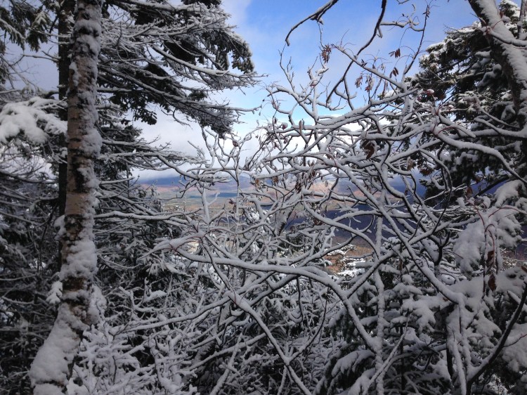
The way down a mountain is always kind of boring during an out-and-back hike, and tends to be more rough on the joints than going up. This adventure proved to be no different, and thanks to my ambitious speed on the way up, I was moving more slowly than ever on the way down. We broke off into two groups, with two people leading the way and two of us following quite a ways behind. This turned out to be a good thing, however, because when we came to the rocky ledge beyond the junction, there was a break in the clouds moving across the mountains which offered an absolutely breathtaking view, completely unlike what we saw on the way up.

IMG_2714

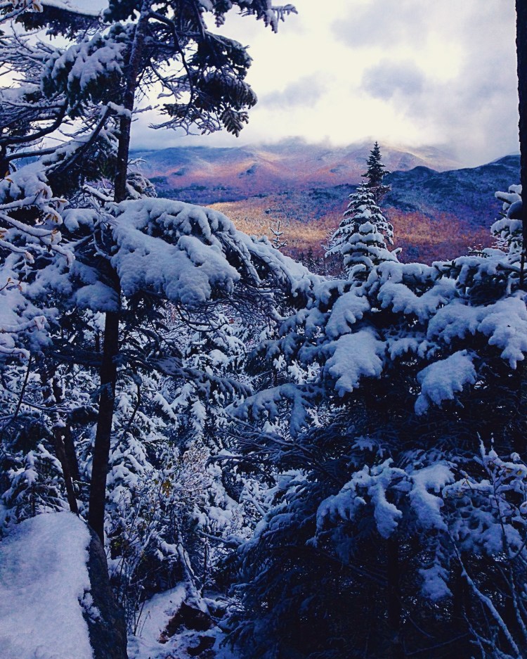
My friend stopped for a moment to take in the incredible sight, but she was eager to continue our descent. I had a hard time pulling myself away from the most rewarding part of the entire day’s hike! After I was done taking hundreds of photos and taking in the moment of beauty, we made our way back down the herd path the same way we came up.

IMG_2679_2

When we reached the two stream crossings, we didn’t stop to spend any time considering our best option for crossing – we just forded through, boots on and all. We didn’t want to waste time taking our footwear off and finding the best spot to cross, since we were tired and running out of daylight. We may have underestimated how far the trailhead was from the Indian Pass Brook, and for that entire stretch my wet boots felt like cement blocks on my feet. Before long, however, we reached the end (or beginning?) of the herd path where it met the Mount Jo trail and found the exact point where our instructions steered us in the wrong direction that morning. We passed Heart Lake and came out at the trailhead near the Adirondack Loj, proud to have bagged two more high peaks and eager to get our hard-earned pumpkin pie milkshakes from Stewart’s!

IMG_2716_2
Summit selfies are a peak-bagging tradition!

Have you ever hiked an unmaintained trail? Share your experiences in the comments below!

Keep exploring,Alli Signature.png

Throwback Thursday: First Girls’ ADK Adventure Part I – Giant Mountain

Cold, rainy day on Giant Mountain with no summit views.
It was a cold, rainy day on Giant Mountain with no summit views.

For this edition of Throwback Thursday we’re taking it back to October 2014 for our first “Girls’ ADK Adventure Weekend”. You know what’s truly awesome? Having fantastic female friends who love trails, mountains and adventures as much as you do. I am lucky to have met some inspiring and fearless ladies in the past few years whose appetite for adventure is absolutely contagious.

Packed for Girls' Adventure Weekend - what could possibly go wrong?
Packed for Girls’ Adventure Weekend – what could possibly go wrong?

After bagging my first high peak in the spring of 2014 with my partner, I was aching to get back to the mountains for some more adventures. When the idea for a ladies’ high peaks trip came up at the bar after a kickball game, I knew I had to go! After hearing about an easily accessible camping area close to the Giant Mountain/Roaring Brook Trailhead, we decided we would rough it for a fall weekend and attempt 3 High Peaks: Giant Mountain, Cascade Mountain and Porter Mountain. We decided to depart on a Friday evening after work, knowing we would be arriving to set up camp in the dark. We weren’t very worried because we had it on good authority that our camping spot would be easy to find and close to the parking lot. Off we went – four women and a Goldendoodle.

Wet leaves in the Giant Mountain Wilderness Area.

The drive went by quickly and uneventfully, but that’s probably because I slept a good part of the way there. However, once we got to Keene Valley things started to get challenging almost immediately. This too-good-to-be-true camping spot turned out to be impossible to find, likely because it was nothing like what was described to us. We followed the instructions from our trusted source to a T only to find the parking area completely surrounded by “No Camping” signs. It was late, dark, and we were following bad directions in an unfamiliar area. We were not at all prepared to venture out for a hike to find a designated camping spot, as we weren’t planning a backpacking trip. Car camping is more of what we had in mind. In our tired, frazzled daze we decided to park at the Giant Mountain/Roaring Brook Trailhead and wander in a short distance to find a place to set up camp. Every flat area that looked ideal was met with a nearby “No Camping” sign as well. We gave up, running out of time and energy, and decided to camp a little ways off trail and risk eviction if some night-prowling park ranger were to stumble upon us.

Giant Mtn Trail Sign

We managed to set up camp pretty quickly and get settled in for some sleep. Three of us shared a tent, while another stayed in a separate tent with her dog. I must have been exhausted because even after my car nap I fell right asleep. The other ladies didn’t have as much luck and hardly slept. Of course it didn’t help that a short time later a large group of people came down the trail and set up camp all around us – loudly. I’m really surprised at how well I slept; I only woke up briefly once and fell right back asleep. The others hardly slept at all, partially due to the fact that the our new camp neighbors were up talking and laughing directly outside our tents for much of the night.

Before the light rain turned into heavy rain, and we went from being a little damp to dripping wet.

We wanted to get an early start for our Giant Mountain hike, but when our 6:30 am wake up time came none of us felt like moving. A reminder that we should pack up camp before it started to rain was enough to get us to all sit up in unison. We packed up even faster than we set up the night before. There were almost a dozen tents all around us, filled with hikers who had been asleep for only a couple of hours, or so it seemed. We loaded our gear into the car and used camp stoves to make (instant) coffee and oatmeal in the small parking lot. We packed our daypacks with water and supplies and ventured onto the trail just as it began to rain lightly.

Exploring the top of Roaring Brook Falls.

The light rain eventually turned into a moderate rain which become a heavy rain for much of our hike. For two ladies it was their very first high peak, and for two of us it would be our second. None of us were willing to let the weather stand in our way. We made our way up toward the summit of Giant via the Roaring Brook Trail. A short ways into the trail there is a split where hikers can go straight to Roaring Brook Falls or left to continue up to Giant’s open rock summit. The falls didn’t appear to be much farther on the trail map, so we decided to check it out before continuing up Giant. Because we were still low enough in elevation to avoid complete cloud cover when we reached the top of Roaring Brook Falls, it offered the best view of the area we got all day. We rock-hopped across the brook and made our way to the top of the falls to take in the breathtaking sight.

A view of some fog lifting over the mountains from the top of Roaring Brook Falls.

After exploring Roaring Brook Falls we continued to follow the trail all the way up to the summit of Giant. The 3.4 mile trail ascends 3,375 feet from the Roaring Brook Trailhead to the summit, and has several steep sections that require scrambling – hand over hand climbing. The rain never let up and only became heavier as the day went on, turning the trail into a muddy stream for us to traverse during our several-hour climb. This was a pretty exciting trail, and it would have been a lot of fun to hike in more favorable conditions. However, we were soaked to our core, freezing, and growing more surly with each difficult step.

The most misleading sign you will ever read. That last one tenth of a mile goes straight up.

We finally reached a rocky clearing with a sign indicating we were 0.1 miles from the summit of Giant Mountain – our goal destination felt within reach! You heard it here first – that was the absolute longest one tenth of a mile in my entire life! Be warned – that sign is very deceiving, especially when you are cold, soaking wet, tired and eager to head back. We pressed on, nonetheless, eventually summiting the mountain with high winds, falling snow and complete cloud cover.

Survey marker at the summit of Giant Mountain.

While it was difficult to enjoy the moment in the conditions we faced, we all still felt the significant sense of accomplishment that only comes with touching a survey marker after such adversity (admittedly, hikers and climbers all over the globe face much greater adversity than cold rain – this isn’t Everest, after all). A couple of us still managed to crack open a ceremonial summit beer and scarf down a sandwich before beginning our long, cold, wet descent back to the trailhead. The rain eventually let up, but not until well after each one of us was so uncomfortable that the thought of tenting another night was completely unbearable. I think most normal people would have cut their losses and headed home to relax and recover from such a grueling experience. We aren’t most people, though.

Summit of Giant Mtn
After all of our hard work, this was the scene that greeted us at the summit.

Read Part II of our “First Girls’ ADK Adventure Weekend” here!

Have you ever had a bad-weather adventure? Share your experiences in the comments below!

Keep exploring,Alli Signature.png

High Tor Wildlife Management Area & Conklin Gully

A section of trail overlooking Conklin Gully.

I’ve been interested in checking out the trails in the High Tor Wildlife Management Area for quite some time. So when I got a text message from a friend Friday afternoon asking if I was interested in joining a last-minute hiking trip to the area I just couldn’t say no. The High Tor Wildlife Management area is located just east of Naples, NY, about an hour away from Rochester. Tor refers to a hill or rocky peak, which accurately describes the terrain of this area. Hikers are treated to steep wooded hills, eroded cliffs, gullies and waterfalls.

The Hi Tor Blue Trail entrance at the parking area off Parish Hill Rd.

We drove to the parking area off of Parish Hill Road to find a trailhead for the Hi Tor Blue Trail. We set out to hike up to an overlook with a view of Canandaigua Lake, checking out a bit of Conklin Gully along the way. We didn’t bring a trail map since we thought the trails looked pretty straight-forward from our internet research (ha!). Unfortunately it didn’t take very long for us to realize we were no longer following a marked trail and needed to regroup. Around this time we started to hear gunfire in the area, reminding us that we were hiking in a popular hunting area during hunting season. As we discussed how near or far the gunfire might be, we noticed a few shotgun shells on the trail near our feet – ugh! I have no problem sharing outdoor spaces with all types of recreationalists, but I have zero tolerance for those who litter. Leave no trace means exactly that, and leaving shotgun shells on the trail is no different than leaving a granola bar wrapper – just don’t do it, okay?

IMG_2976_2

We were a little nervous about hiking with two dogs in this area during hunting season, but we decided that it was getting late enough in the day to not pose much of a threat. We backtracked to where we saw the Blue Trail markings turn toward the gully and proceeded along the trail, hoping to make our way up to the Canandaigua Lake overlook. Before long, we crossed a shallow, rocky part of the gully and followed the trail up to a steep ledge along 100 ft. sheer walls. This portion of the trail offered amazing views of the gully’s rocky walls and waterfalls below.

Steep part of the Hi Tor Blue Trail leading up to a camping area and scenic overlook.

After stopping to take in the scenery and snap some photos, we pressed on and reached a point where the trail widens to a space large enough to fit an ATV. At this point the trail becomes pretty steep, and goes straight up until a large clearing with a lean-to, outhouse, food locker and fire pits. This is a beautiful camping spot at the Canandaigua Lake overlook, but unfortunately camping is seasonal and restricted to organized groups by permit only.

A well-maintained lean-to on the Hi Tor Blue Trail.

We stopped for a while again to enjoy the spectacular view of the lake and conveniently use the outhouse near the camping area. A few hikers came from the other end of the trail and stopped briefly to chat. They had driven from Buffalo to spend the day in the area. We decided to follow the Blue Trail a bit longer, until it intersected a section of the Finger Lakes Trail that connected back to the steep, wide section of the Blue Trail again.

A gorgeous fall view of Canandaigua Lake.

On the way down we wandered off trail a bit to explore a tributary which ran into the gully, creating a small waterfall. We climbed down to the top of the waterfall and looked over the steep ledge down to Conklin Gully before making our way back to the trailhead via the Blue Trail.

IMG_3056
Standing on the “edge of the world!”

As we passed by the Conklin Gully overlook section of trail again, we noticed two men hiking through the gully below us. A popular way to hike this area, particularly in warmer weather, is to hike straight through the gully. Some sections of the gully have steep waterfalls, and sometimes there are ropes to help hikers traverse these sections. The waterfall directly below where we were was one such section, and we watched the men use the rope to climb up alongside the waterfall with ease.

Two men hiking through the gully below, approaching a steep waterfall.

It was a short hike back to the trailhead, which made us realize exactly how far out of the way we had initially gone when starting out. Overall it was a very enjoyable hike, with some challenging uphill sections, gorgeous views and exciting terrain. I’m already looking forward to coming back to the area in warmer weather to hopefully hike all the way through the gully. We’re also hoping to plan a section hike of the Finger Lakes Trail, which passes through the High Tor Wildlife Management Area and connects to the Hi Tor Blue Trail. So much to explore!

We're coming for you, Finger Lakes Trail!
We’re coming for you, Finger Lakes Trail!

What’s your favorite hiking spot in the Finger Lakes? Share your experiences in the comments below!

Keep exploring,Alli Signature.png

Namaste & Nature: Hikyoga™

Hikyoga™ class overlooking Lake Ontario.
Hikyoga™ at Chimney Bluffs State Park overlooking Lake Ontario last month.

I love yoga, and I love the outdoors. It only makes sense then that I would eventually find a way to take my practice outside, right? Usually my practice takes place at my gym’s Vinyasa class, interspersed with some occasional hot yoga classes at the local Bikram studio. The first outdoor yoga class I took was in July 2014 when Rochester Young Professionals offered the outdoor recreation event “Yoga in the Park” led by Sarah from Inner Bloom Yoga. The event took place near the Sunken Garden in Highland Park – a truly beautiful setting for a peaceful practice right in the city of Rochester.

RYP's Yoga in the Park event in July 2014.
RYP’s Yoga in the Park event in July 2014.

I loved the class and the instructor did a great job, however I hadn’t heard about many other opportunities for outdoor yoga classes in the area since. Through social media and friends near Washington, DC I heard about something called Yoga Hikes DC and I thought it sounded like a terrific way to combine two of my favorite activities – and I wished such a thing existed in Rochester, NY. So I was thrilled to open up the Democrat and Chronicle one day to find an article about a Webster woman guiding adventures in area parks that blend hiking and yoga. Count me in!

Hiking along the Bluff Trail during a Hikyoga™ event.

I signed up for the October 4th Hikyoga™ at Chimney Bluffs State Park in Wolcott, NY. Chimney Bluffs State Park is about an hour east of Rochester. The park offers hiking in wooded trails and along the lakeshore featuring incredible views of the razor-sharp bluffs. The steep cliffs and rock/mud formations were carved by glaciers and are constantly evolving due to erosion.

Chimney Bluffs

Nicole Kazimer led a good-sized group of us through a yoga warm up, hike to the bluffs, and a full yoga class in a grassy area of the park overlooking Lake Ontario. The hike was mostly flat and not very long, less than two miles total. We ventured out to an overlook on the trail with views of the impressive bluffs, then went back the same to way we came to our spot on the lake for an invigorating yoga practice. There was a pleasant breeze and the sound of Lake Ontario’s waves crashing against the shore added a special ambiance to our meditation that really made me feel connected to nature.

Hiking along the steep ledge of the Bluff Trail.

Overall it was a truly wonderful experience and I’ve been dying to join another Hikyoga™ outing, but schedule restrictions have gotten in the way of previous and upcoming events. If you’re interested in attending, check out Nicole’s website www.helloyogagirl.com to learn more. You can also follow her on Instagram for some wanderlust-inducing yoga shots at @helloyogagirl.

Have you ever tried a yoga hike? Share your experiences in the comments below!

Keep exploring,Alli Signature.png

Re-establishing a Running Routine

A gorgeous day on the trails might be enough to pull any runner out of a slump!

I have a confession to make: I did’t run for almost 4 months. Okay, so that might not seem too crazy. But it’s the longest break I’ve taken in almost four years since I began my running/fitness journey. In those four years I ran a full marathon, five half marathons, several 5Ks and countless trail and road races of other distances. From mid-July to November 2015 I ran zero miles.

2015 running stats showing no activity in the months of August, September and November.
Full disclosure: I’ve put up some terrible running stats this year. But note the complete lack of anything for August, September and October. Yikes!

Now, it’s not like I was a total slob – I went on some great bike rides, many walks, and even some pretty amazing hikes during that time. I took some yoga classes, joined an indoor beach volleyball team and got in a few nice gym workouts. I also wasn’t without my reasons for taking a hiatus, which I am choosing to keep private for the time being. But the fact remains that the long break started to cause some palpable physical, mental and possibly even emotional changes. I didn’t feel like myself when I wasn’t running, but for some reason getting started again felt so difficult. Why is that?

Photo of running sneakers and iPhone armband.
I wonder if my running shoes enjoyed their vacation?

Sometimes, especially when it comes to fitness routines, it feels like starting again means starting over. According to Active.com, “it takes about seven to 14 days for your aerobic fitness to start declining.” The full impact of taking a few months off depends on a number of factors, including the intensity and frequency of your running. For me, as you can tell from those MapMyRun distance stats, I wasn’t running consistently prior to my hiatus. Not only was I likely facing a significant loss in aerobic fitness, but my body’s structural fitness was suffering as well. I became apprehensive to get out and run, knowing I would be nowhere near my peak or even previous fitness level.

A sunny fall day on the Genesee Riverway Trail.
This is what awaited me on my first post-hiatus run in Turning Point Park. I couldn’t ask for better running conditions.

You might be wondering, what finally changed? Well, I think the stars aligned a bit and I worked up the courage to just strap on the ol’ running shoes and make my body do the thing that used to feel as natural as eating or breathing. Here in Rochester, we’ve been blessed with a few exceptionally warm and mostly sunny days to start the month of November. Thanks to the ending of Daylight Saving Time, I’ve found a new motivation to wake up early (gasp!) and run outside in order to savor the only hours of daylight not spent at work. I’ve only logged 3 runs so far since the beginning of the month, and I’m feeling a bit sluggish but overjoyed to be back at it. I’m looking forward to rebuilding some speed and endurance and setting some new running goals for 2016 and beyond!

View of boardwalk over the Genesee River through trees.
Looking at the Genesee River boardwalk from the wooded trails in Turning Point Park. According to social media, that section was a highlight of the MVP Rochester Marathon’s new course. 2016 goal race?!

What are your running goals? Share your experiences in the comments below!

Keep exploring,Alli Signature.png